Extracts from The Border - A History in 10½ Chapters
Border Warfare
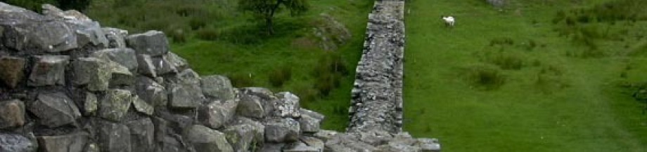
The history of the Anglo-Scottish border is one of the bloodiest anywhere in the world. It also has the dubious honour of being one of the longest lasting conflicts. The Romans arrived sometime after 70AD and built the city of Luguvalium in the west as a military frontier town. 1700 years later, that city, now known as Carlisle, was still being besieged by invading armies from the north. Once the neighbouring countries had become established by the 10th century, Carlisle was at times Scottish and at others English. On the other side of the country, Berwick was busy changing hands some 10 times before - like Carlisle - finally settling south of the border. As we shall see later, Berwick's strange place in history even led to it being at war with Russia between the years 1853 and 1966 (despite the fact that the rest of the country was not).
At the western end of the border is an area once known as the "Debatable Land". Neither nation controlled this territory and no laws governed it, although both countries agreed that anyone found to be within it could legally be murdered.
Berwick-upon-Tweed
Arriving at Berwick,we were welcomed by a group of workmen. Tony asked the way to the Bed and Breakfast. I took out the map I had printed from the web and spent a couple of minutes pouring over it before realising that the lines and shapes, numbers and words on the piece of paper in front of me bore absolutely no resemblance to the streets and shops all around us.
"Can you see a river anywhere?" I asked Tony who was now also staring at the map.
"Are you sure it's the right Berwick?" he enquired, but I ignored him and was already busy switching on my GPS and aiming at the cloudless sky, waiting for it to make connection with the satellites out there in space. The map had a grid reference which I eventually confirmed with the GPS, so we were clearly close to what the map was showing. The best thing to do was start walking. I told myself that it would do Tony's confidence no good were we to get lost two minutes into the adventure. Christ, in a few days time we would be walking over the summits of the Cheviots, no doubt in atrocious weather, so what hope would we have if we were to get lost just outside Berwick railway station? Besides, we were now being stared at by the heavyweight workmen, perhaps because I was pointing my GPS at them and they may have thought I was trying to take a photo using a badly camouflaged mobile phone.
"This way", I said to Tony before heading right and ending up in what declared itself as "Tweed Street". Convinced that we were by the river (where we didn't want to be), I guided us towards the left and then a circular short cut via the main Castlegate, before aiming towards the North Road (where we did want to be). Twenty minutes later we passed by the station again, going the other way, although I managed to distract Tony for a couple of minutes, so I think I got away with it.
Finally we arrived at the Bed and Breakfast where I had booked us a twin room. The door was opened not by a pretty girl*, but by an old dog.
"Ann?" I asked peering behind the ageing border collie (obviously) at the woman who was staring out from the gloomy hallway into the sunlit street.
"Aye, that's me. You'll be Antony and Antony then." There was no hint of a question mark, so I decided to forego the point of correcting her. "You'd better come in."
We signed the various forms, gave a credit card imprint and were taken up to the attic where we found our twin room. Overall very pleasant and no complaints, although, as would be a feature of the trip, our room doorkey was attached to a keyring some 4 times larger than itself, and attached to this keyring, as well as the key, was an object some 4 times larger than the keyring. In this instance it seemed to be a large piece of tree bark. The third object attached to the keyring was a circular plate with the room number and name and address of the bed and breakfast. I know these people attach such large objects to the keyrings in a vague attempt to stop you losing it, but I'm not convinced it is the most secure of methods. To be wandering round a strange town with a piece of wood sticking out of your pocket (if you can fit it in there), with directions to the door it opens is surely an open invitation to be mugged.
However, I squeezed the thing into my mini rucksack and Tony and I set off for a walk up the coast to find the most easterly point of the Border. As we left Ann shouted after us. "Don't lose your key" and the old collie grinned.
* There is an old song which goes:
"Berwick is an ancient town,
A church without a steeple,
A pretty girl at every door,
And very generous people"
In the Cheviots
The Cheviot range was created some 380 million years ago, the spilled out remains of a massive system of volcanoes, which cooled to form a kind of rock called andesite (which gave its name to the similar, but more giant Andes). In the middle is a core of granite, pushed upwards over time, and often to the very top of the hills themselves, especially where natural erosion has stripped away the andesite. For this reason, the tops of the hills are generally rounded and smooth with very few crags. This makes what seems on the map a daunting prospect actually a lot easier. Add to that the fact that this is a National Trail and you are soon able to relax and enjoy the spectacular views without ever feeling too much in danger. Obviously the weather helps: in our case it was probably just a little bit too hot - the sky remained cloudless all day. It will obviously be a lot more treacherous in mists, rain or snow, and when we took respite in one of the Mountain Refuge huts, it was more out of interest and getting some shade than for any other reason. We met quite a number of other walkers - some who were dressed like they had just stepped out of the morning church service - and it almost impossible to get lost (although we did) as you follow the border line fence or walk on the huge sandstone slabs which had been laid there for our convenience over some of the more marshy areas.For the record, we headed up out of Kirk Yetholm and made our way to the Border at Corbie Crag and Black Hag. From there we climbed up The Schil, 601m high and that's where we got lost, despite the map, GPS and compass. As we reached the summit, I was surprised too see a taller hill right in front of us and to the left. Studying the map and responding to the many text messages on our phones (we had finally reached signal-territory), I noted with a little despondency that the hill in front was in fact The Schil and we had miscalculated - we were still on Corbie Crag. "Bollocks", I shouted loudly, and the echo woke up a group of ravens (Scots name "corbies") who fluttered off from a dip near the summit, confirming our error. Incidentally, there are two possible collective nouns for ravens - "an unkindness of" and "a storytelling of", although the first one seemed more apt at the time. So off we trudged up The Schil, then down, then up, then down, then, then down towards the Mountain Refuge hut, which had a few packet of biscuits, drinks, bedding etc.
To the south (again rather oddly) was Scotland separated by a wire fence, or in places, two wire fences, with a sort of mini No-Man's land in between. To our north was a deep valley, caused by glaciation 10,000 years ago, called Hen Hole. According to Eric Robson, this is a place where the sun never penetrates and which can hold patches of snow, hidden away in the rocks, even on such a day as we were having. Down below, the College Burn, gradually gaining in strength from its source on Cheviot, flowed north. There is of course no institute of further education in this remote area - the name probably comes from two Anglo-Saxon words "col" and "lecche", meaning a "stream through boggy land".
After a few minutes rest we began the ascent of the eponymous Cheviot itself, the highest summit in the range at 815 metres (2,674 feet), although the Border turns sharply away before reaching the summit and double backing on itself to head west along the ridge. This was the busiest part of the route, as if a number of hikers had come out this way simply to go up and down the highest slopes. We passed a woman, struggling and cursing her husband who had rushed on ahead, his testosterone driving him to the Auchope Cairn, which marks the highest part of the Border. Coming down in the opposite direction, a large family group of nine, the patriarch wearing a huge sombrero, and casually smoking a cigar. A couple of nine year olds wearing Liverpool football strips rushed past us, almost knocking over a young couple, dressed for a night out, looking very sad. I imagined they were the victims of some dreadful romance which had all gone wrong. Despite both having other partners, they had met for the first time last night in a disco in Wooler, fallen immediately in love, realised the hopelessness of their situation and were going to end it all by jumping, hand-in-hand to the bottom of Hen Hole. I watched them, helplessly aware of the futility of it all, but rather than jump, they made straight for the Refuge Hut, and, it seemed, hung a "Do Not Disturb" sign on the door. Tony came back a few steps: "You alright?" he asked.
"Oh yes, just the heat I think."
"Hallucinating yet?"
"Yes. You?"
"Ever since The Schil."